

Beinn a' Bhuird [Beinn a' Bhuird North Top]
Good walks are even better shared.
NJ0900 : Taking a tentative look down the east side of Beinn a' Bhuird, North Top
Elliott Simpson Photo source
Overview
Beinn a' Bhuird [Beinn a' Bhuird North Top]
Situated in the heart of the Cairngorms National Park, Beinn a' Bhuird stands majestically at 1165 meters, making it one of the prominent Munros in this rugged landscape. Its rocky terrain offers a delightful challenge for hikers looking to soak in some of Scotland's most awe-inspiring views.
Geology
The geology of Beinn a' Bhuird is primarily granite, a resilient rock that has shaped the lofty and dramatic contours we see today. The exposed faces of granite add to the mountain's rugged appearance and also provide a safe perch for many alpine species.
Routes
Two popular routes to summit Beinn a' Bhuird are the From the Linn of Dee and the Munro Circuit. Each option ensures spectacular scenery and a good leg workout. Remember, it's not just the destination, but the journey (and the snacks along the way) that counts!
Summit Features
Upon reaching the summit, you'll be greeted by a large cairn that seems to have been patiently waiting to collect stories from all the adventurers that have crossed its path. Perfect for a quick selfie or just a moment to embrace the peace of the mountains.
Terrain Type
The adventure up Beinn a' Bhuird is varied – expect a mix of rocky paths and boggy bits that could do with a warning sign: 'Here Be Squelchy Footprints'. A good pair of waterproof boots is a must!
Views
Stand on the summit and drink in the breathtaking views. On clear days, the panorama stretches far and wide, showcasing fellow Munros and the shimmering waters of the distant North Sea. It's a view worthy of a postcard – or at the very least, a solid Instagram post!
Hazards
While the climb is rewarding, be cautious of the weather, which can turn faster than you can say 'Scotland'. The paths can be quite treacherous when wet. Always respect the mountains and check conditions before setting off.
Nearby Summits
Don't miss out on the nearby peaks, such as Beinn a' Bhuird South Top and Ben Avon. These summits offer additional challenges and equally stunning views that would make any summit bagger's heart skip a beat!
Access
The nearest parking is at the Linn of Dee car park, which can fill up quickly. Aim to arrive early to snag a prime spot. Public transport options are limited, so planning ahead is prudent.
Facilities
While out in the wild, don't forget that amenities are just a drive away in Braemar. Stock up on hot beverages and snacks at local cafes before your trek.
History
The etymology of Beinn a' Bhuird is steeped in lore, hinting at its intriguing past. As part of the Cairngorms, the mountain has stood sentinel over generations, marking its importance in local histories.
In summary, Beinn a' Bhuird is not just a mountain; it’s a grand adventure waiting to be explored. Whether you're stepping out with friends or seeking solace in nature, make sure to pack your sense of wonder and a few extra snacks for the journey ahead!
Enjoy your expedition, and remember: the mountains are calling, and you must go!
Explore routes near Beinn a' Bhuird [Beinn a' Bhuird North Top]
Walks starting near this hill. Open a route to check its map, distance and full itinerary.
Rothiemurchus: Beaver Trail and Lochan Mor
View route
Aviemore: Loch an Eilein and the Croft Track from Rothiemurchus
View route
Cairngorms night walk and stargazing (event meeting)
View route
Cairngorms night walk and stargazing (event meeting)
View route
Route planning notes
These notes describe possible approaches. Check a route's map and access information when planning your walk.
From the Linn of Dee
This popular route starts at the Linn of Dee car park and follows the path alongside the river before ascending the slopes of Beinn a' Bhuird.
The Munro Circuit
A circuit that combines Beinn a' Bhuird with nearby summits, offering a scenic and varied hike through beautiful landscapes.
Make a day of it, together
Find someone to share the walk with, or organise a day out along a route you like.
Photo Gallery
View all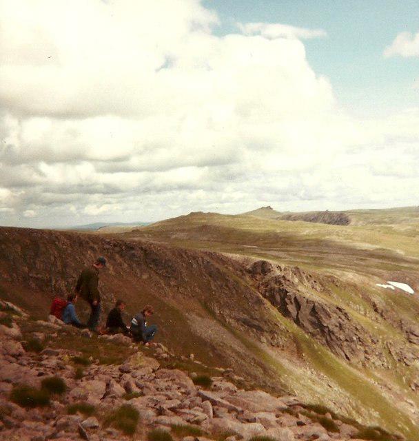 Photo could not load
NJ0900 : Taking a tentative look down the east side of Beinn a' Bhuird, North Top
Elliott Simpson
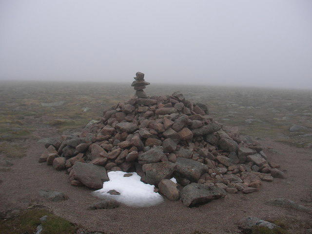 Photo could not load
NJ0900 : Summit Cairn, Beinn a' Bhuird North Top
Sean O'Sullivan
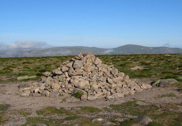 Photo could not load
NJ0900 : Beinn a' Bhuird, North Top
Hill Walker
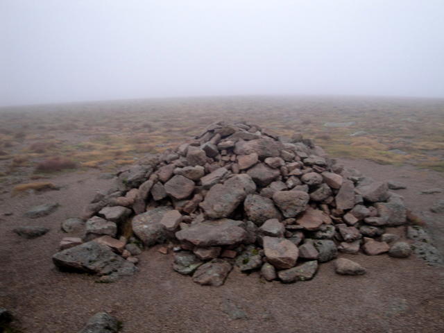 Photo could not load
NJ0900 : Summit of Beinn a'Bhùird
Alistair Pooler
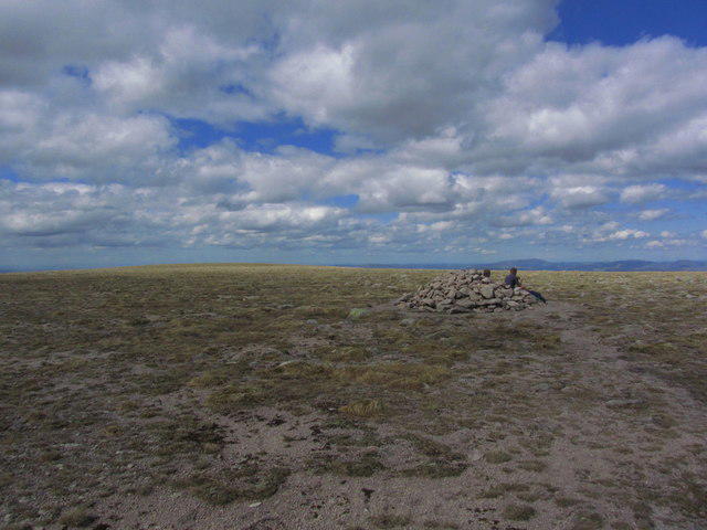 Photo could not load
NJ0900 : The featureless North Top on Beinn a' Bhuird
Colin Park
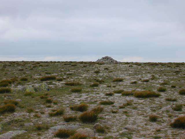 Photo could not load
NJ0900 : The summit cairn of Beinn a' Bhuird
Nigel Brown
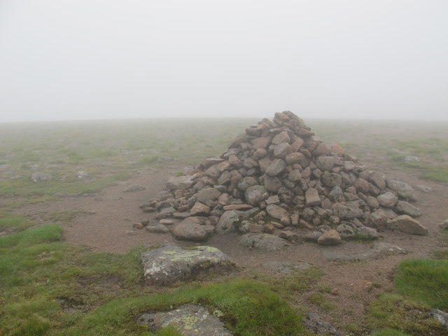 Photo could not load
NJ0900 : Summit Cairn on Beinn a' Bhuird
Alan Hodgson
Hill facts and local notes
Classifications
Elevation
1,196m
3,924 ft
Prominence
456m
Coordinates
57.0876, -3.4994
NJ092006
OS Map
36
Explorer: OL58S 404S
At the Summit
The summit is crowned with a rocky outcrop and marked by a large stone cairn, perfect for a photo op or a moment of reflection.
Terrain & Geology
The mountain is primarily composed of granite, which forms the backbone of the Cairngorm range, providing breathtaking cliffs and ridges that would make even the bravest goats think twice about their climbing routes.
Views & Scenery
On a clear day, you can see the vast expanse of the Cairngorms, other Munros in the area, and even as far as the North Sea. Bring your binoculars if you're keen on spotting distant landmarks.
History & Heritage
Name Origin
The name 'Beinn a' Bhuird' translates to 'Mountain of the Robber', possibly indicating a historical connection to local folklore and Bandits.
Historical Significance
The mountain holds cultural significance as a part of the ancient landscape, often featuring in local tales and histories.
Getting There & Facilities
Parking
Linn of Dee car park (NJ 023 994), which has limited spaces but is a perfect starting point for your adventure.
Public Transport
There are bus services from nearby towns like Braemar during the summer months, but check schedules beforehand.
Nearby Facilities
Braemar offers cafes, shops, and public toilets, so make sure to stock up before setting off.
Safety Information
Known Hazards
- Be cautious of sudden weather changes, especially in winter; footpaths can be boggy and slippery when wet.
General Safety Tips
- Check weather conditions before setting out
- Carry appropriate clothing and equipment
- Let someone know your planned route
- Take a map, compass, and GPS device
- Carry emergency supplies: food, water, first aid kit, torch
Hills
Some common questions about the hills answered
Are there group walks up Beinn a' Bhuird [Beinn a' Bhuird North Top]?
Many walkers use Walkmates to join or organise walks with others. You can check for group walks around Beinn a' Bhuird [Beinn a' Bhuird North Top] through the maps
Are there other walkers around Beinn a' Bhuird [Beinn a' Bhuird North Top]?
Activity varies by location and time, but Walkmates lets you see whether others have shared walks or shown interest in this area. Find other people through the walking friends search walking friends for Beinn a' Bhuird [Beinn a' Bhuird North Top] search or of course create your own walk for Beinn a' Bhuird [Beinn a' Bhuird North Top]
Can I organise a walk to Beinn a' Bhuird [Beinn a' Bhuird North Top]?
Yes. If there aren’t any walks listed already, you can create a walk and make it available for others to join.
If you're signed up to Walkmates, you can create a walk to Beinn a' Bhuird [Beinn a' Bhuird North Top].
How do I find a walk up this hill?
There are often multiple ways to walk this hill, depending on experience and route preference. Walkmates helps you explore walks and routes that others have shared.
Can I suggest a new route up Beinn a' Bhuird [Beinn a' Bhuird North Top]?
Yes. You can suggest or create routes to share with others. Walkmates focuses on the social side of walking, so routes are used to help people organise walks and explore areas together, rather than as detailed navigation tools or route libraries.
Other uses really appreciate knowledgeable walkers sharing their routes. Share your favourite route to Beinn a' Bhuird [Beinn a' Bhuird North Top] here
The is an error or something incorrect about this hill. How do I let you know?
We always strive to keep the information on Walkmates as accurate as possible. If you find an error, please let us know through the contact form and we'll aim to correct it as quickly as possible
Community Discussion
Comments
Location
![Beinn a' Bhuird [Beinn a' Bhuird North Top] location map](https://cdn.walkmates.com/hill-maps/hill-sources/529/57.08759_-3.49938.png)
Grid reference: NJ092006
View on OpenStreetMapOpens a map in a new tab, centred on the hill.
![Ben Macdui [Beinn Macduibh]](https://cdn.walkmates.com/gallery-images/e60cf32aeb394c3282fcdd14a63368f0.jpg)
No comments yet. Be the first.